


Loralai district in the centre of Balochistan province of Pakistan. It is four thousand seven hundred (4700) feet above the sea level . Loralai district was created on October, 1903.

Loralai district's name is is derived from the Loralai stream, which is a confluent of Anambar or Nari, and flow towards the north, where is Loralai town.


Loralai is the principal city of Loralai District . It was formerly known as Bori. Loralai was further divided in 1992 when Musakhel and Barkhan were given the status of separate administrative districts.

Loralai is the principal city of Loralai District . It was formerly known as Bori. Loralai was further divided in 1992 when Musakhel and Barkhan were given the status of separate administrative districts.
The present boundaries of Loralai district contain three sub-divisions. It has three Tehsils
Mekhtar
Bori
Duki
Bori consists of tehsil Bori. Sub-tehsil Makhter become tehsil with the great accesses of Tehsil Nazim Bori (Molvi Abdullah Hamzazai)

Duki sub-division is further divided into Tehsil Duki and Sub-Tehsil Sinjavi. Duki town is located with an altitude of 1092 metres (3585 feet). Duki also happens to be the hottest place in entire administrative Division. It has gained fame as a major Coal deposit.Duki is rich with high quality Coal with highest rate of extraction throughout Pakistan. Coal is the main business of the area. More than 80% of local population is directly related to the coal business.Chamalang mountain range is situated about 40-45 KMs north of Kohlu in tehsil Duki. It is spread over at an area of 7x60 KMs. The Chamalang coal mines due to fine quality of coal and its availability close to surface has the potential to generate significant economy activities in the area including employment capacity

Loralai is also rich in marble industries and its marble tiles are gaining popularity throughout the country. A lot of marble trimming factories have been established in the district and provides marble tiles to various parts of the country.

Largedeposit of fluorite is found in Loralai district and its vicinity in Sulaiman foldbelt. This type of fluorite issed for acid preparation and also as gemstones

Zangiwal is one of the oldest and historical villages of District Loralai. The village is playing an important role in District and Provincial economy due to its various types of vegetables and fruits supplied to Quetta and Punjab.

The major source of income for the common inhabitants is agriculture and farming.The wealth of the inhabitants is derived from their herds of cattle and also other animals. Many kinds of fruits and vegetables are cultivated in Loralai district. It is especially famous for its almond and apple production.

The district is also popular in the business of items especially vehicles. loralai is mainly a central place for business because of provincial border and strategic location.

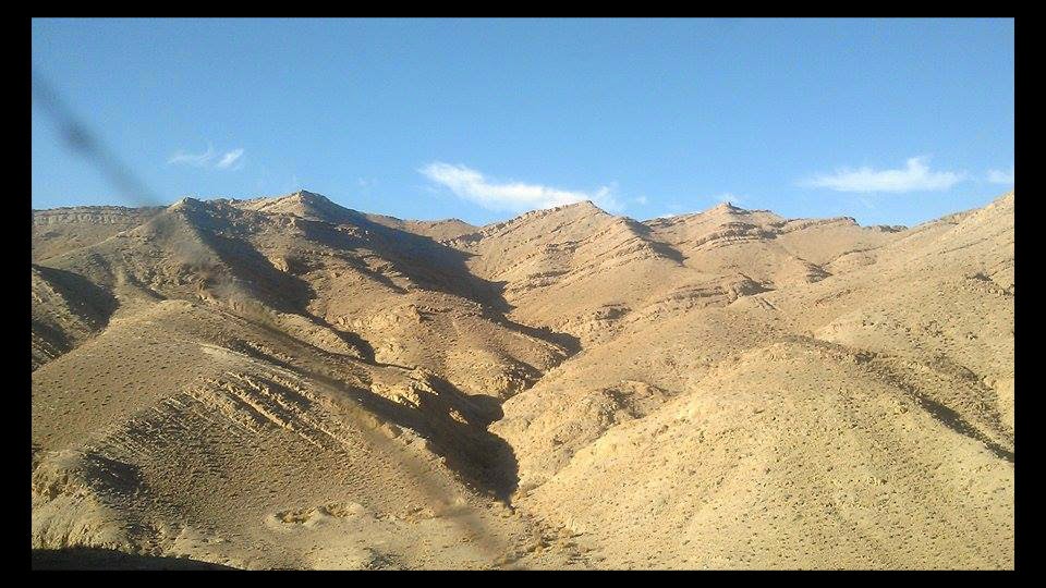
Loralai district is rugged and beautiful. There are many barren mountains in Loralai but also there are some scrub and juniper forested mountains.


The type of the soil of Loralai is that it cannot be used for baked bricks as a baked brick gets brittle. Therefore most of the town is made of mud


On the northern side of the town, there exists an old cantonment established before the departure of the British Empire for the purpose of defence against the Russian Empire.


loralai district has well known educational institutes. Renowned Educational institutions in district include:
University of Balochistan Sub-Campus Loralai
Baluchistan Residential College (BRC), Loralai
Govt Boys Degree College Loralai
Govt Girls Degree College Loralai
Balochistan Institute of IT and Management Sciences (BIITMS) Loralai
Govt Inter Science College Duke
Govt Inter Science College Makhter
Pak-German Technical Training Center
Govt. Elementary College Loralai
Army public school and college system

The distance from Quetta to Lorala.is 257 Km The journey is bit tedious but it gives stunning landscapes. The way is through barren mountains.


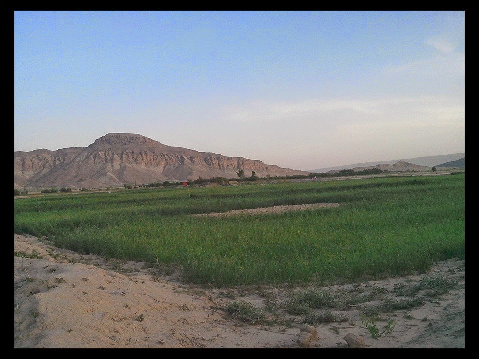
Dargai Sargarh mountain is on the way from Quetta to Loralai. Dargai Sargarh mountain is a flat topped mountain and also known as Jinnah's Cap locally.The shape of the mountain resemble the cap. of founder of Pakistan Mohammad Ali Jinnah.
 |
| Dargai Sargarh mountain |
The distance from Loralai to Ziarat is 94 kms

******************************************************
No comments:
Post a Comment